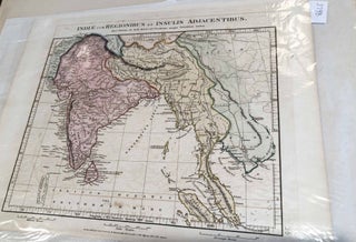
Map Indiae cum Regionibus et Insulis Adjacentibus (India, Burma, Thailand, Viet Nam, Malaysia, China)
London: Edward Stanton, 1828. Disbound. map area ca. 10"x 11" on paper sheet ca. 11" x 14" , paper age toned with light brown spotting, colors a bit faded, but good, Clearly removed from an atlas or other book with printed number 24 at right side of page when viewed..... More