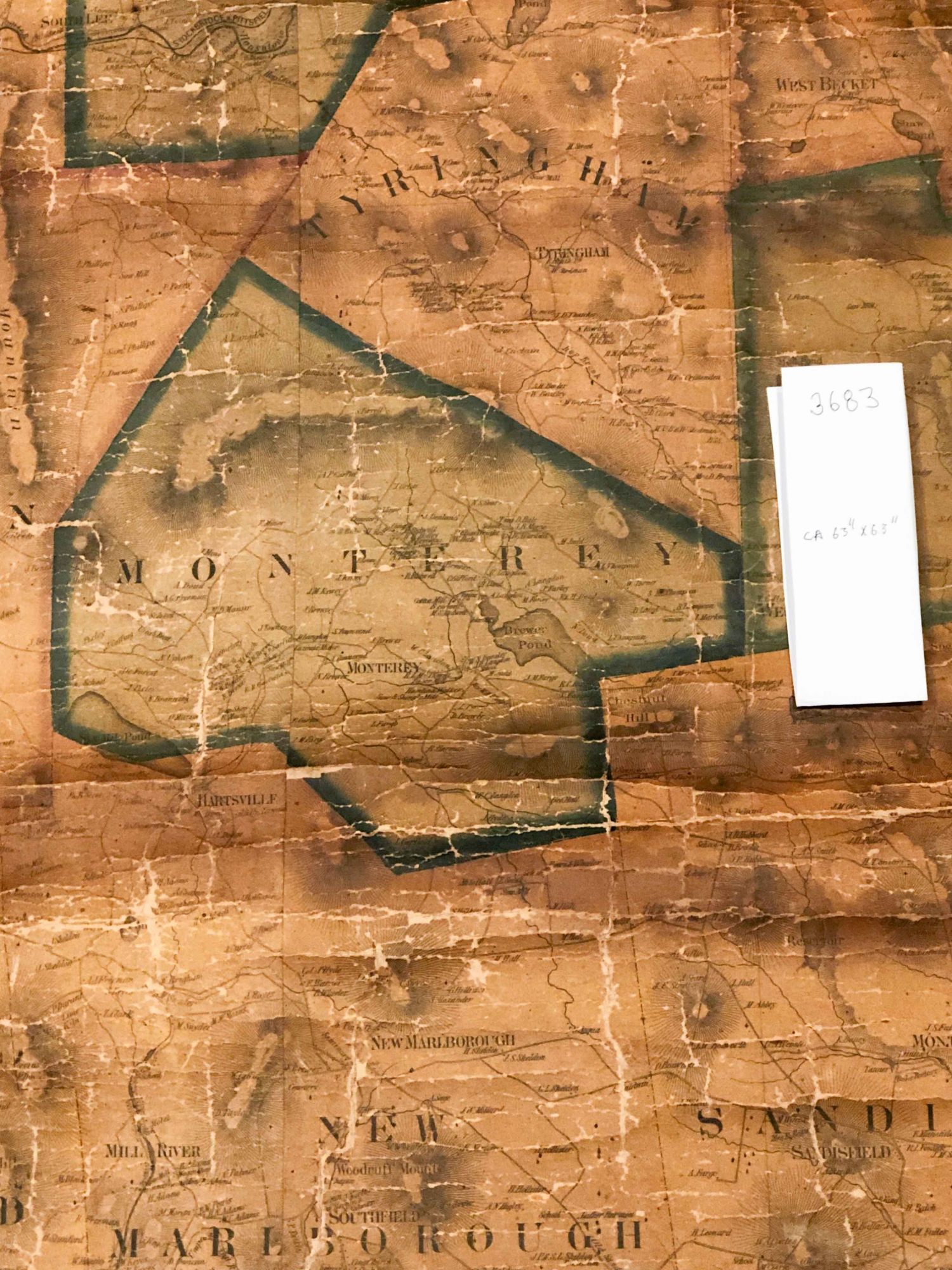
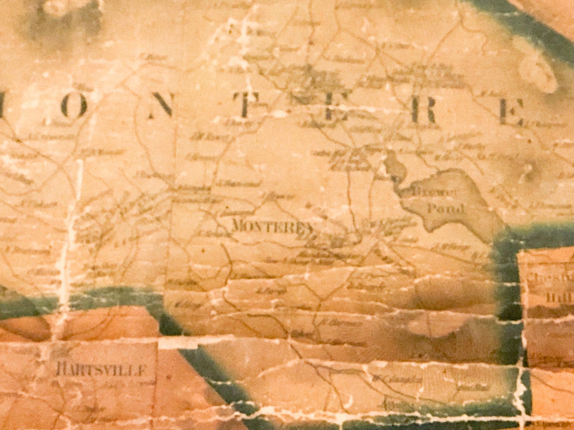
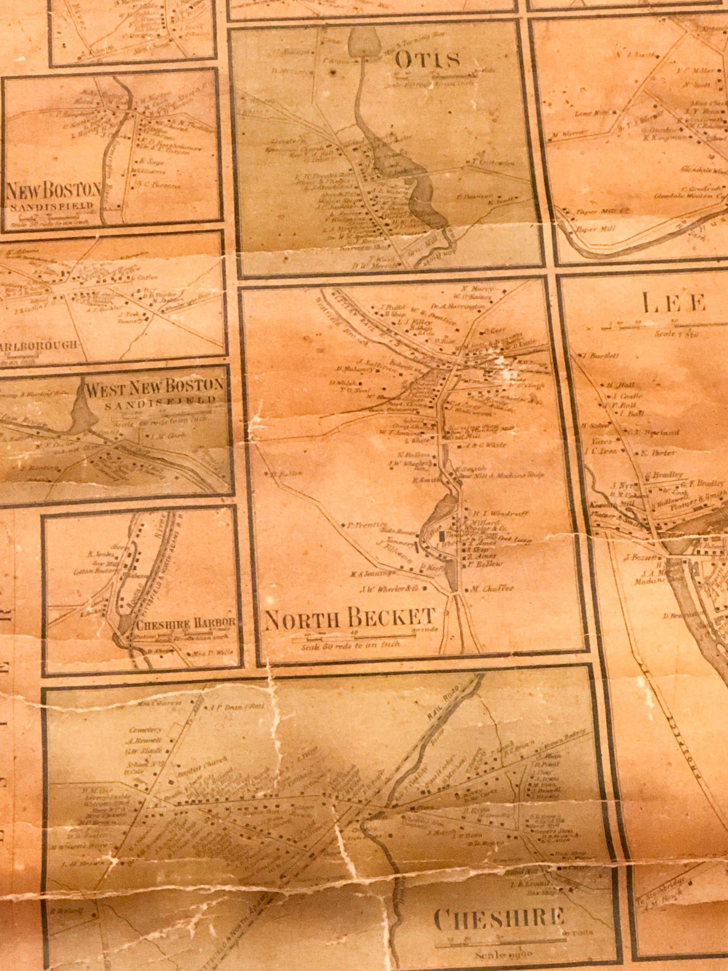
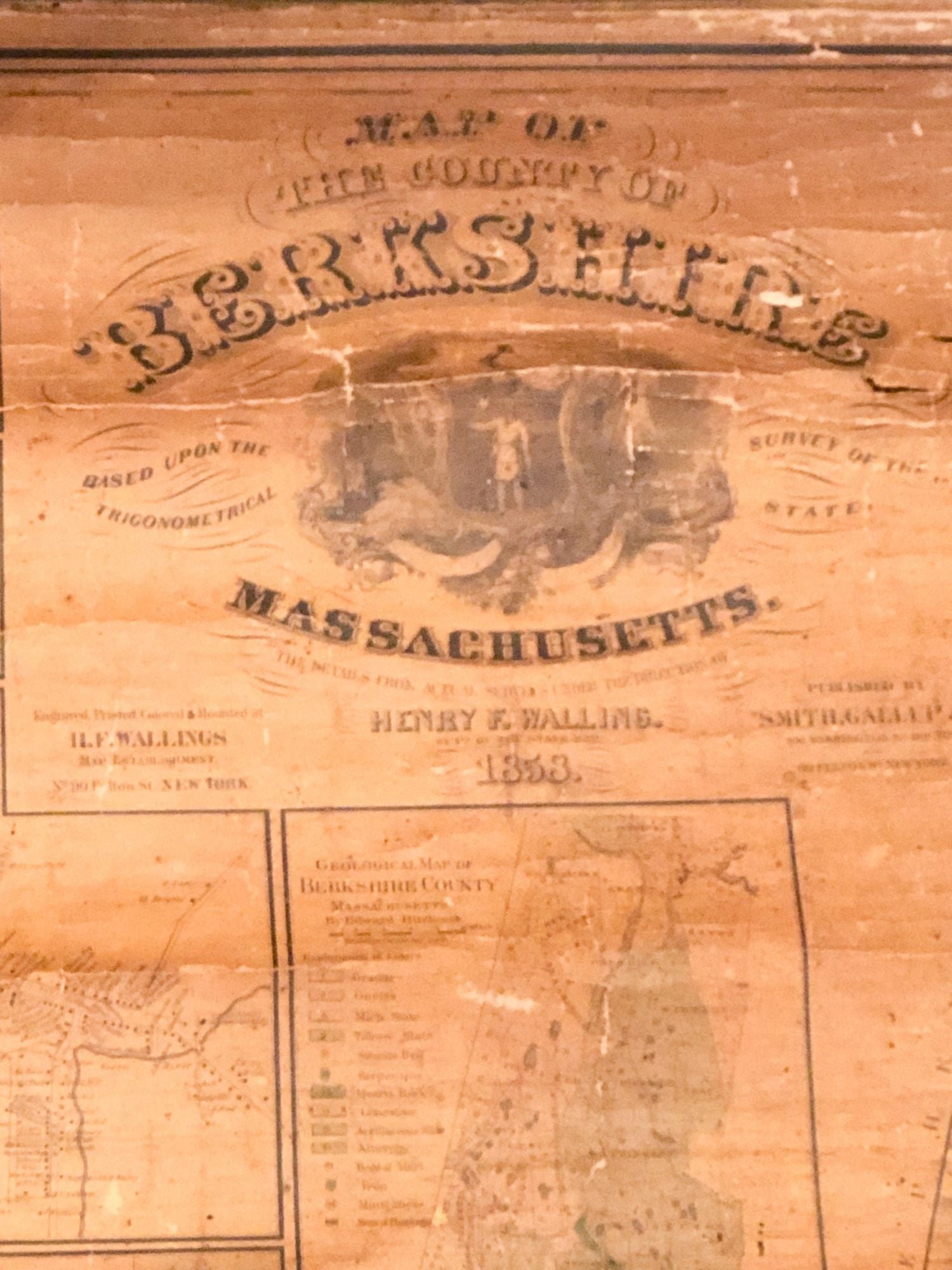
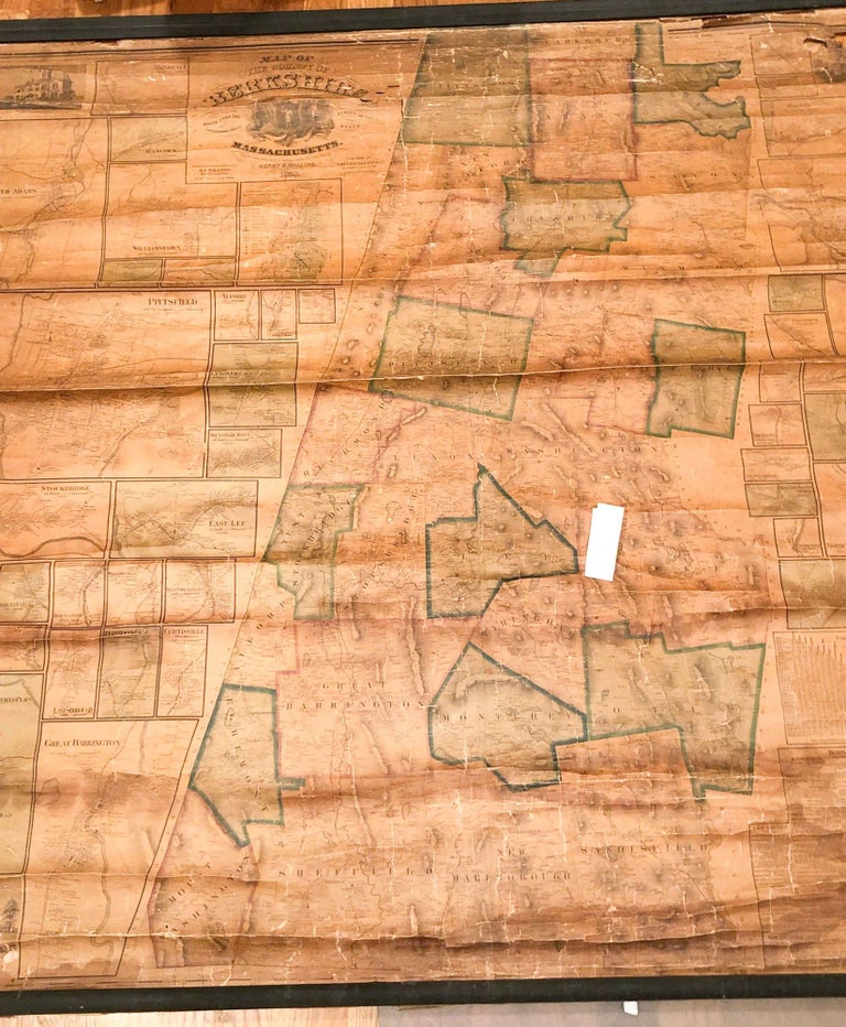
Map of County of Berkshire Massachusetts details from actual surveys under direction of Henry F. Walling 1858
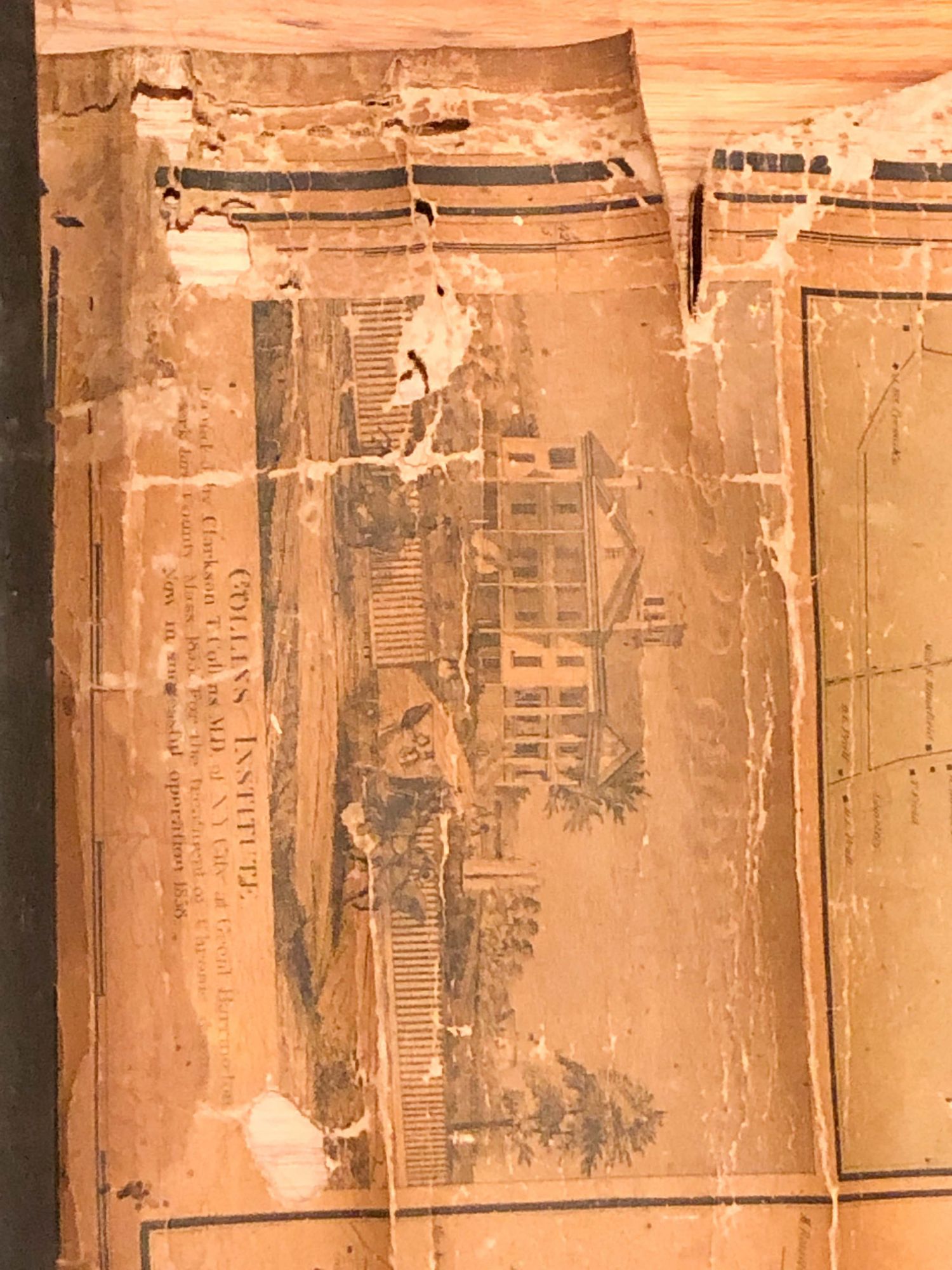
Boston: Smith Gallup & Co., 1858. Early Edition. Cloth. rolled wall map dated 1858, ca. 63" h x 63" wide. including boundary, main map at center with many smaller village and town maps shown along with several vignettes of important residences. The map area is dark from age and exposure- it may have hung somwhere a very long time or was stored in a warm place a long time. There are also many small holes and a few larger ones. There are some stains- the largest to the lower right of the map, where it does not have a big effect on the contents. The top and bottom wood supports for hanging are both present and attached, the the condition of the map at the top make it questionable whether it should be hung with the weight of the bottom stick without some added support or strengthening of the backing toward the top. The outline colors are still discernable, Map paper and cloth underlayer are fraying at the edges. Overall, fair to poor copy, but a scarce survivor. Note: due to size and weight, shipping outside the USA will be much more expensive than an average book. Poor - Fair. Item #3683
Price: $531.00