
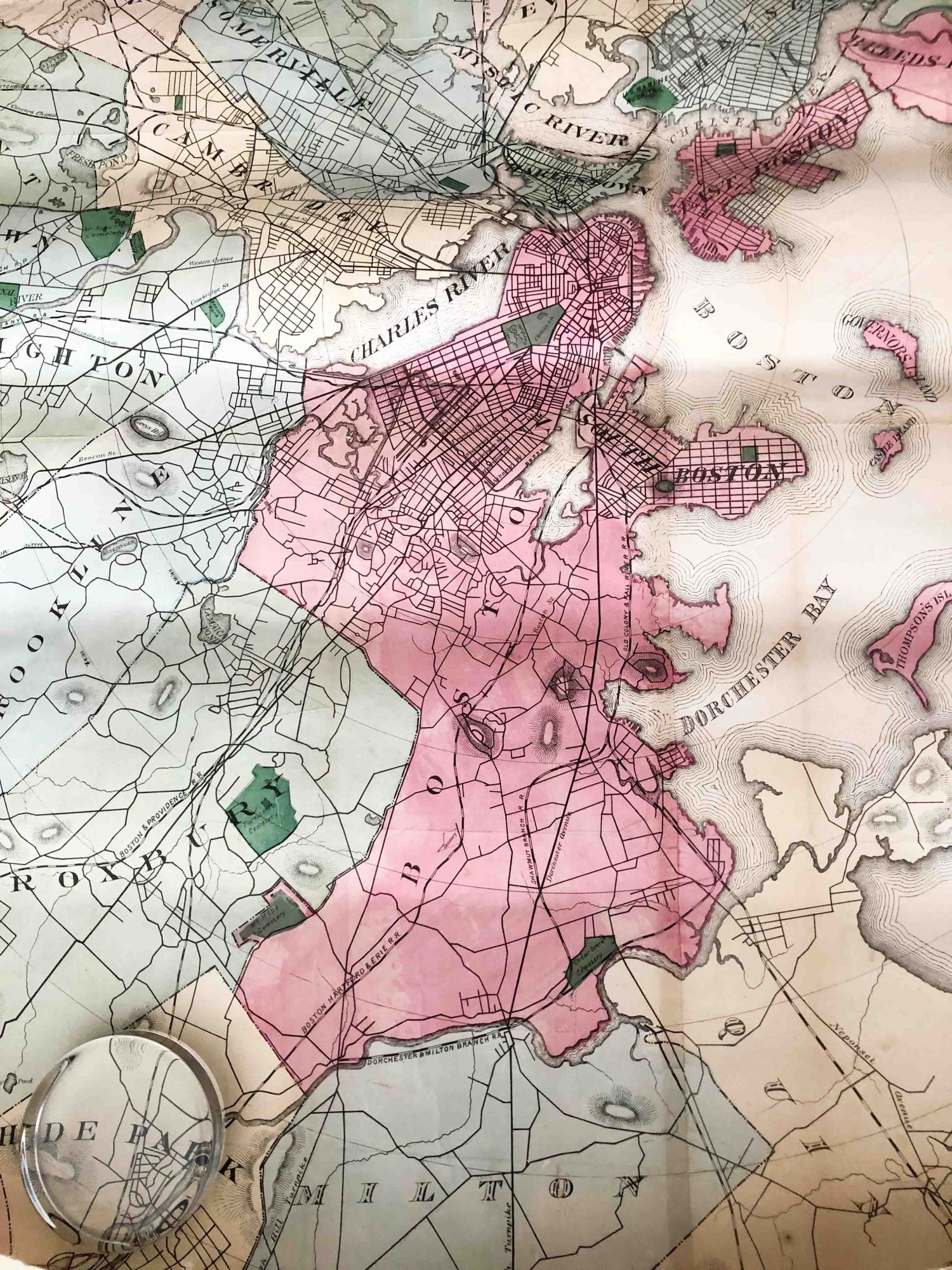
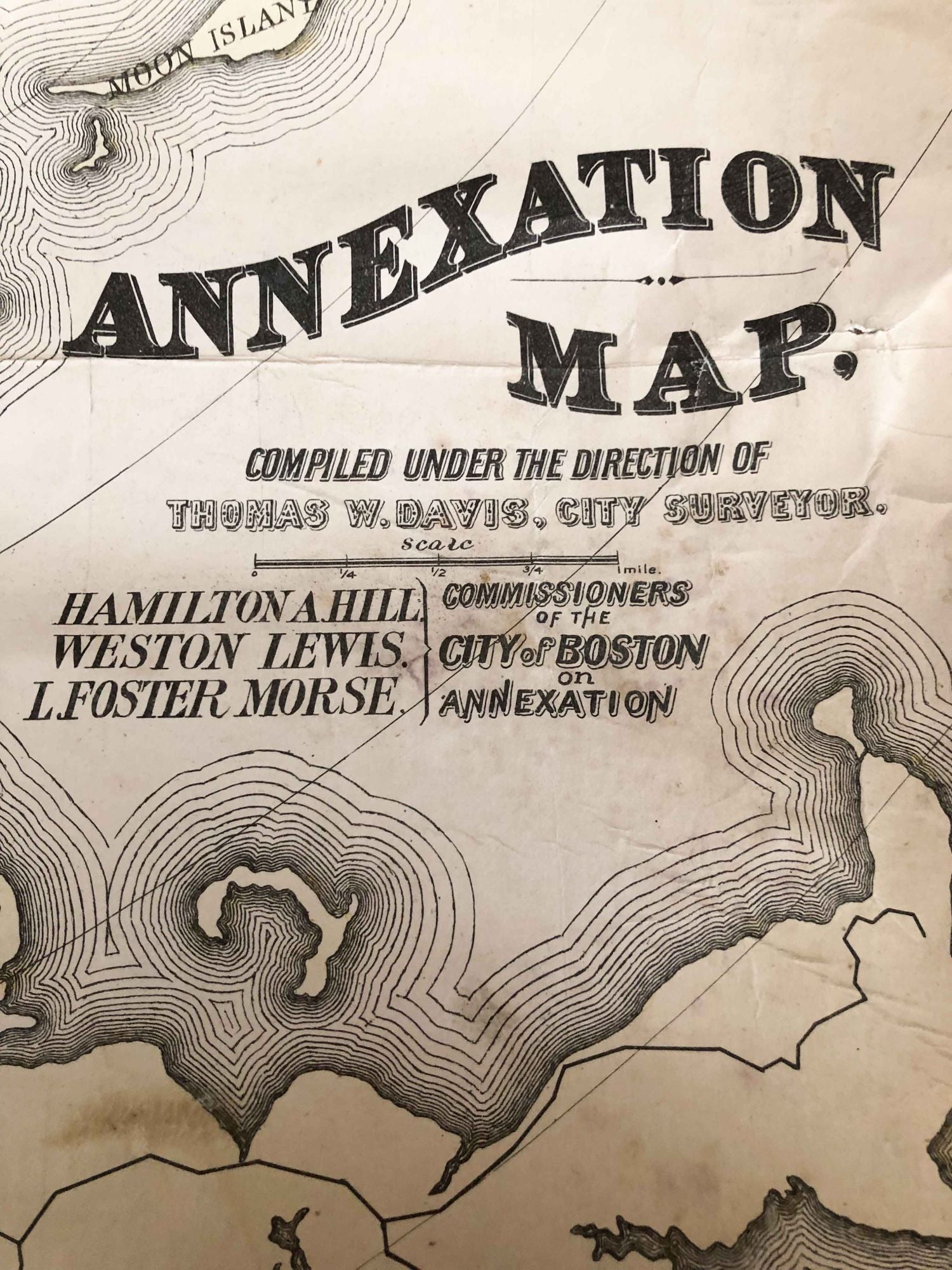
Boston Annexation Map (1872)
Boston: Boston Annexation Commission, 1872. early. unbound. linen backed paper wall map, good color, but a bit dull, Open size ca. 41" wide " x 39" high, paper and linen backing is soiled and chips missing around the edge and a bit frayed there, but otherwise in good condition. This is undated, but ca. 1872. There was a report on the subject published in 1873. This has been rolled up for a very long time, and will take time to flatten. It will be shipped in a tube which will require priority mail or UPS shipping. Note: due to size and weight, shipping outside the USA will cost more than that of an average book. Good. Item #3730
Price: $128.00
See all items in
Cartography
See all items by Thomas W. Davis, surveyor