
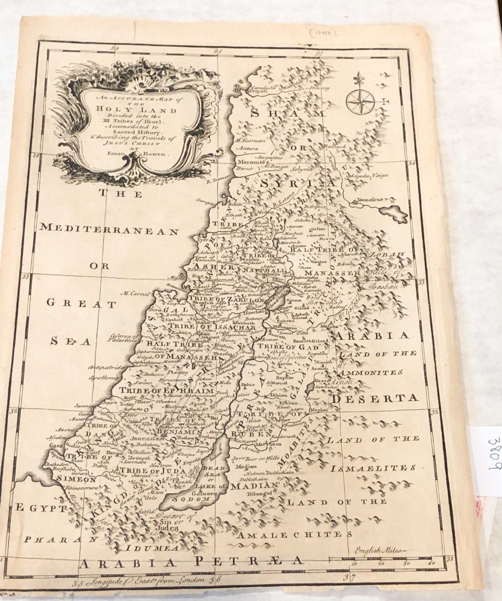
An Accurate Map of the Holy Land Divided into the Twelve Tribes of Israel, Accomodated to Sacred History & describing the Travels of Jesus Christ
London: Bowen, 1752. early. Disbound. map area ca. 9"x 12.6" ( ca. 22.7 x 32.2 cm) on paper sheet ca. 10" x 13.5", paper age darkened -but evenly so. Text in English. The map depicts the tribal areas and has a scale in English miles at lower right corner. There are small chips of paper lacking from the lower edge, but not affecting map area. This was, likely, from Bowen's "A complete atlas or distinct views of the known world" published ca. 1752. Overall, a fair to good copy. Due to size, this will be shipped flat fold or rolled to minimize cost and possible damage, but may cost more to do so. Fair - Good / No Jacket. Item #3809
Price: $123.00
See all items in
Cartography
See all items by Emanuel Bowen