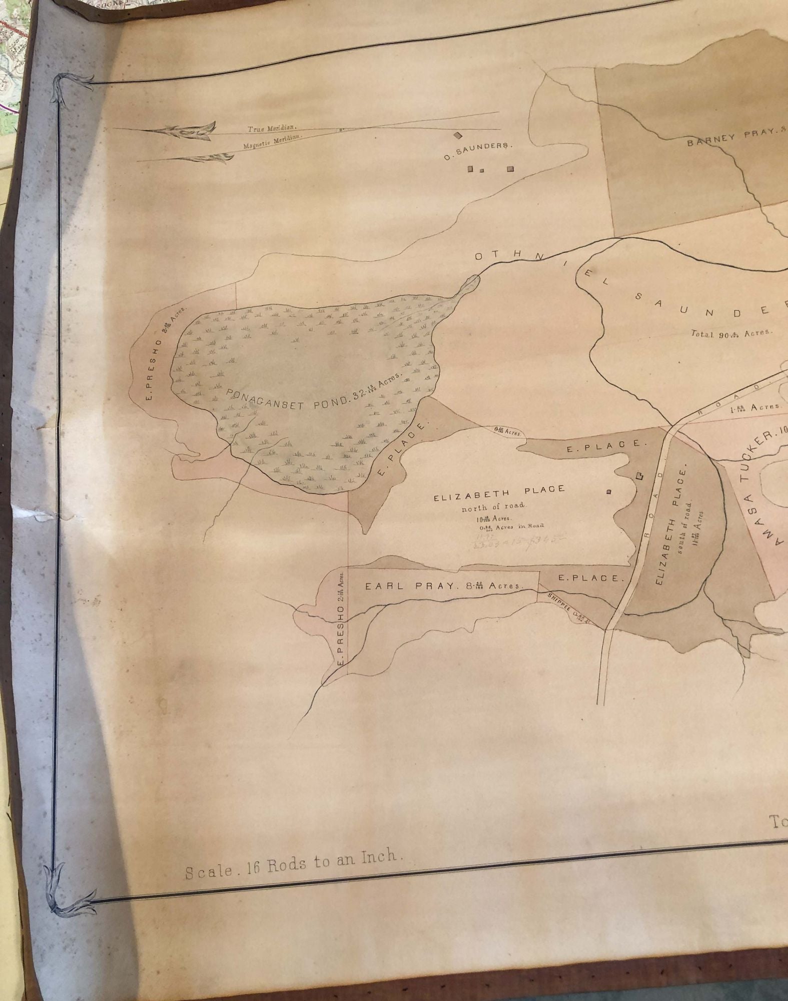
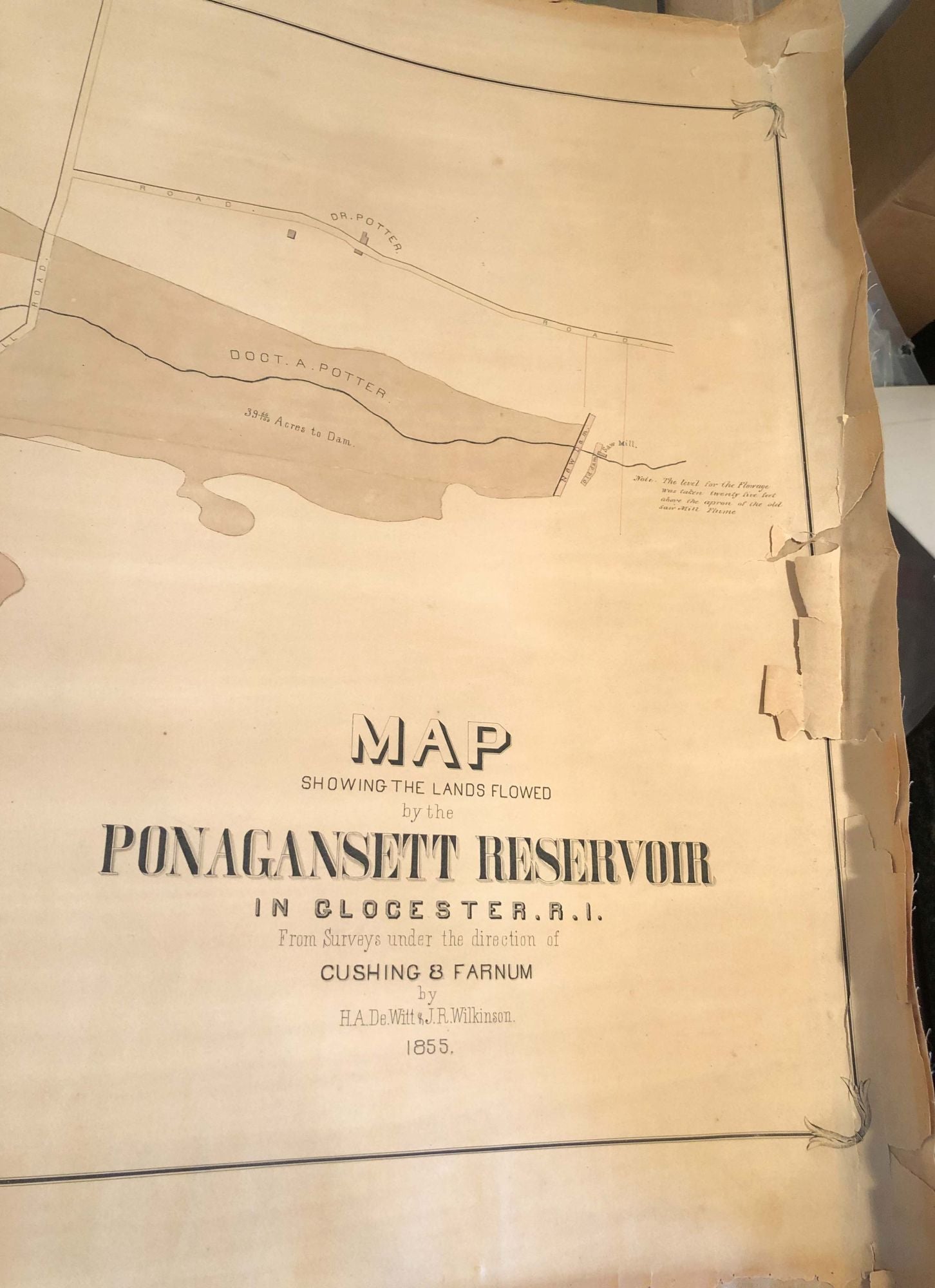
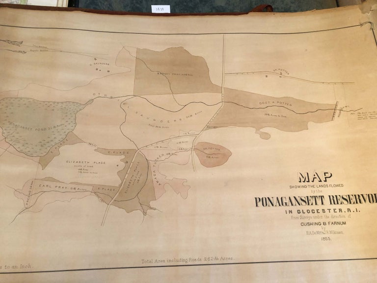
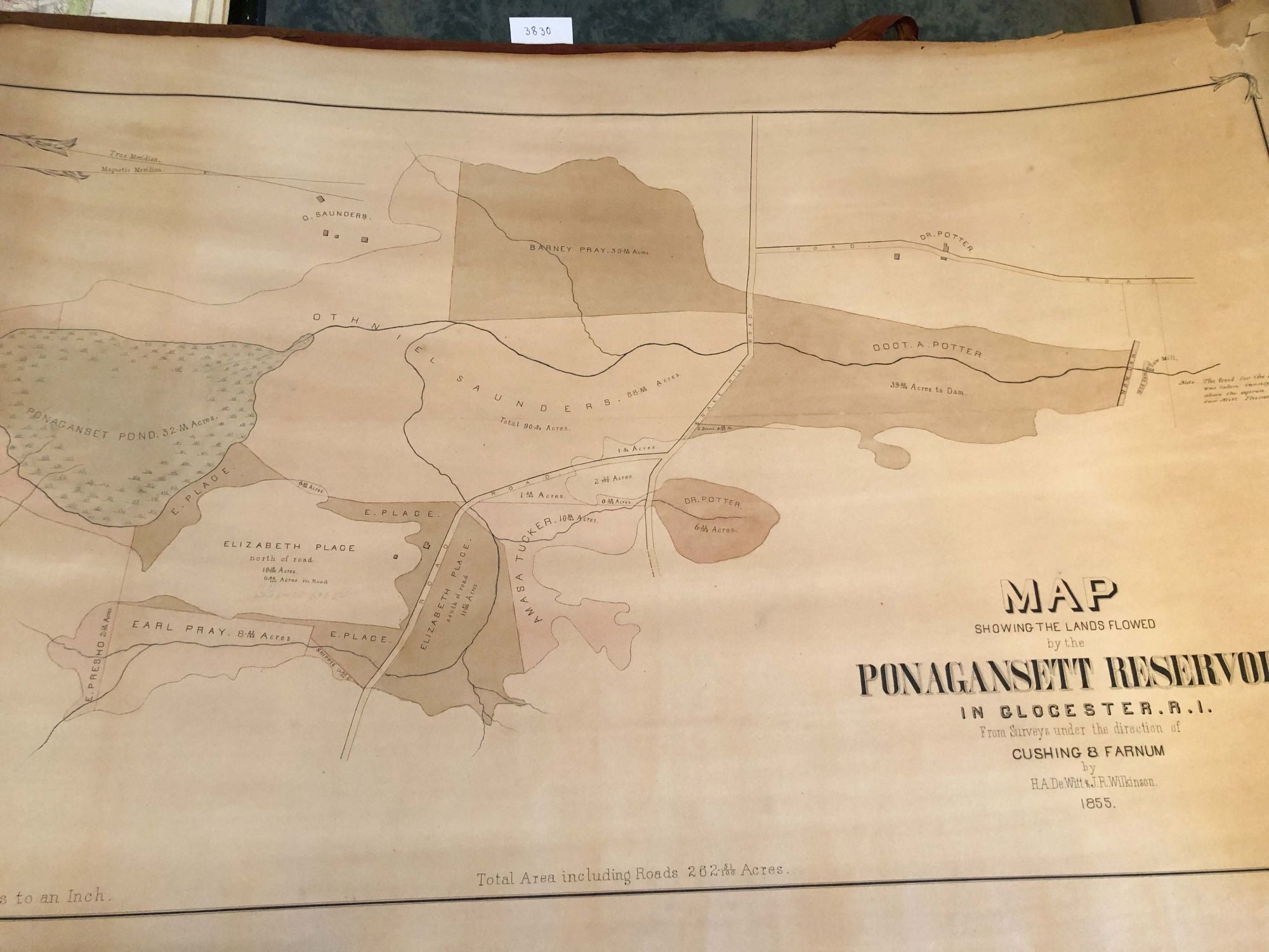
Map Showing the Lands Flowed by the Ponagansett Reservoir in Glocester, R. I. (1855)
Glocester: H. A. DeWitt and J. R. Wilkinson, 1855. Early edition. unbound. linen backed map ca. 22.5" H x 35" faint colors of various parcels, structures and wet areas and property lines indicated. Has, apparently, been rolled up for a long time- quite dusty, faded, cloth border lacking from right end and hanging loose from top and bottom edges for ca. half the width, but that border cloth is present. The right end has seen more wear and tear with some tears going just inside the fancy black ink border of the map area. Age darkened, fair over all condition, but map area good but faded and dusty. It is likely this was made soon before or after a New Dam (indicated on map- along with old dam) was completed and indicates the land owners who were affected. The outline of the reservoir on the map, appears to closely match the shape of the current reservoir. Note: map, likely will be shipped rolled, as it would be impractial to send flat and it has been rolled a long time- it appears. Fair - Good. Item #3830
Price: $191.00