
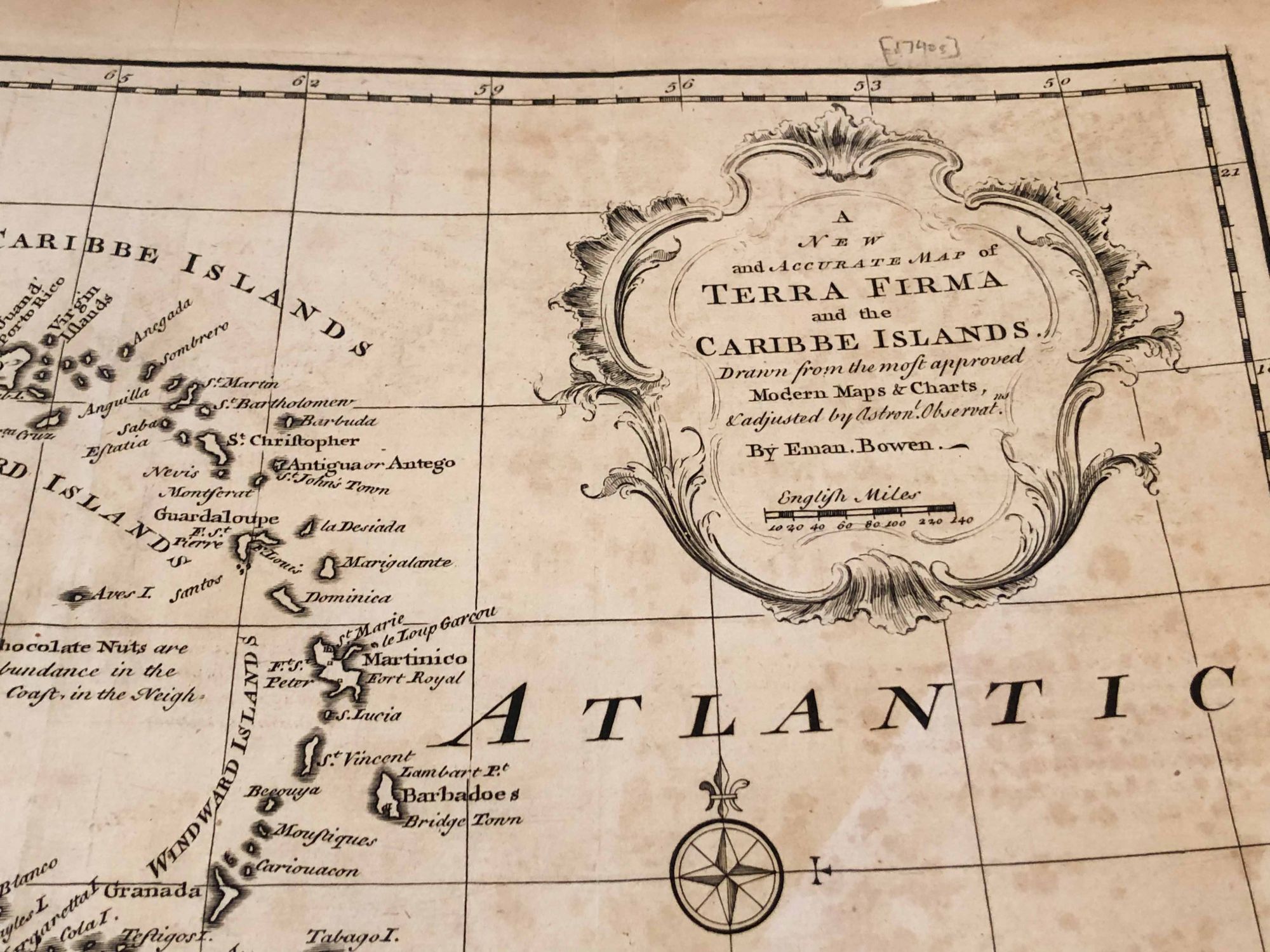
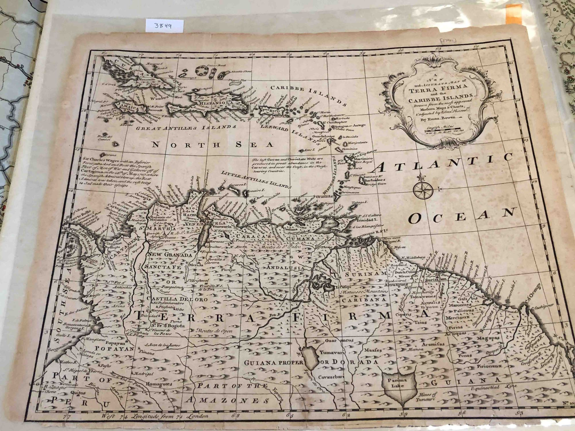
New and Accurate Map of Terra Firma and the Caribe Islands
London: 1745. Early edition. unbound. map with map area ca. 16.8" W x 14" H, no coloring , Paper age darkened, sheet has a fold- probably , it came from an atlas. There is no date- estimating ca. 1745. There are short tear around the edges, but the map information is clear. If the paper were less dark , it would be a good to very good copy. Calling it good- fair. Note: this map will be folded and mailed flat. For international shipping, this may be costly. Fair - Good. Item #3849
Price: $47.00
See all items in
Cartography
See all items by Emmanuel Bowen