Cartography
These are items about maps and map making. Also included are many Maps and Atlases. Others might be found in Travel or Travel Guides sections.
America in Maps Dating from 1500 to 1856
New York: Holmes & Meier, 1976. First Edition. Hardcover. elephant folio, bound in original green cloth covered boards in fine condition, maybe a little dust. Contents fine with reproductions of 76 maps of the Americas. Many maps are b&w while many are color. Colors bright. pp. 293 including maps and..... More
The Furthest Shore Images of Terra Australis from the Middle Ages to Captain Cook
Cambridge: Cambridge University Press, 1995. First Edition. Hardcover. quarto, bound in original blue color cloth covered boards in very good to near fine condition. corners slightly bumped, top edge dusty, Contents near fine or fine. pp. 180. no names or bookplates noted inside. dust jacket also very good to near..... More
Atlas of Properties on the Line of Pennsylvania R. R. from Rosemont to Westchester (incomplete)
Philadelphia: A. H. Mueller Co., 1897. half leather. Large folio atlas ca 16"x 21" , bound in original half leather with black cloth covered boards. The leather is deteriorated and much of it is gone. The covers are covers are attached but the joints are a bit weak. The coveres..... More
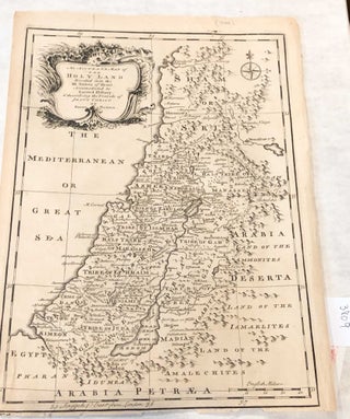
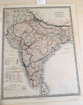
An Accurate Map of the Holy Land Divided into the Twelve Tribes of Israel, Accomodated to Sacred History & describing the Travels of Jesus Christ
London: Bowen, 1752. early. Disbound. map area ca. 9"x 12.6" ( ca. 22.7 x 32.2 cm) on paper sheet ca. 10" x 13.5", paper age darkened -but evenly so. Text in English. The map depicts the tribal areas and has a scale in English miles at lower right corner. There..... More
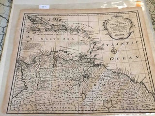
New and Accurate Map of Terra Firma and the Caribe Islands
London: 1745. Early edition. unbound. map with map area ca. 16.8" W x 14" H, no coloring , Paper age darkened, sheet has a fold- probably , it came from an atlas. There is no date- estimating ca. 1745. There are short tear around the edges, but the map information..... More
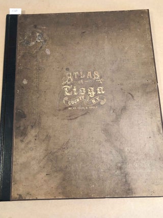
Atlas of Tioga County New York
New York: F. W. Beers, A. D. Ellis, G. G. Soule, 1869. First Edition. Hardcover. folio, ca. 13" x 16" nicely rebound retaining the original cloth on new boards with new black leather backstrip and new end papers. Light wear to covers, but the retained cloth on covers is heavily..... More
The History of Australian Exploration
Sydney: Turner & Henderson, 1888. First Edition. Hardcover. thick quarto, bound in biege color cloth covered boards with moderately heavy soiling, but, in good condition. X- library copy with numbers on spine and some ink stamps inside and blind stamp on back cover ( the binding is from the library)..... More
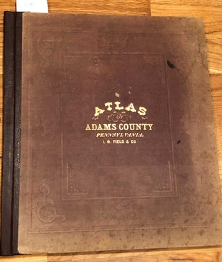
Altas of Adams County Pennsylvania (1872)
Philadelphia: I. W. Field & Co., 1872. First Edition. Hardcover. folio atlas ca. 14"x 15.5". of Adams County, Pennsylvania, 1872, rebacked in brown leather retaining original boards with blindstamped cloth that are in good condition. Gilt lettering in front cover in good condition, but dull, corners bumped, contents complete with..... More
A Classical Atlas, to Illustrate Ancient Geography comprised in 25 maps...
London: William Tegg, 1853. First Edition. Hardcover. quarto, rebacked in black morocco, corners with just remnants of old leather and heavily worn, marbled paper covered boards with moderately heavy soiling, there is a bookplate for a church library on the front pastedown with name of the book's donor. Some pencil..... More
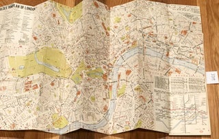
Foldex miniplan London street index and guide
London: Foldex, 1980. early. Paperback. paper folding map, folding to ca. 3.5" x 5" , Open size ca. 13.5" x 23", paper is lightly age toned and soiled, map near fine copy with bright colors, no clear date given 1980 is estimate, but there is one possible date "195?" that..... More
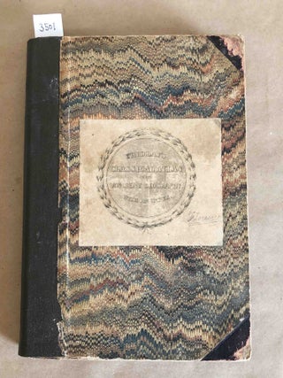
Catalogue of Books, Maps, Plates on America and of a remarkable collection of Early Voyages
Amsterdam: N. Israel, 1966. facsimile reprint. Hardcover. Octavo, facsimile reprint of extensive catalogs of Frederik Muller from 1872- 75 with comprehensive index added at rear. Light to moderate wear, spine printed title partly worn off, covers good, contents very good, three "x's" in ink on top edge of book. Note..... More
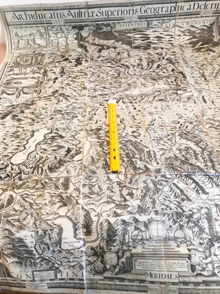
Archiducatus Austriae Superioris Geographica Descripto (old map upper Austria 1808)
Linz: Friedrich Eurich, 1808. Early Edition. Disbound. very large ca. 122cm x 114cm, linen backed folded map of part Austria , published 1808 in Linz, but probably a reproduction of a 1762 or 1669 map. Very interesting to examine. Paper is age darkened and soiled there are many dampstains which..... More
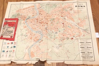
Pianta Di Roma
Rome: G. B. Paravia & Comp. 1925. early. Paperback. paper folding map, in 18 panels folding to ca. 4.75" x 8" and bound into red paper covers, covers frayed, backstrip is now white tape, free library stamp insideOpen sze ca. 22" x 28", paper is lightly age toned and lightly..... More
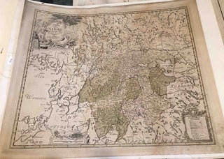
Charta Nerike (south central Sweden)
n.p. 1750. early. disbound. large, ca. 19 " x 22.25" on paper size 21"x 25" that is linen backed. Appears to have been kept flat a long time and with no folds. Map area with some faint coloring. Map is undated, but not a new reproduction - estimating 1750. Text..... More
Charta Ofwer Skane (south Sweden)
n.p. 1750. early. disbound. large, ca. 21 " x 24.75" paper size that is linen backed with printed map area smaller at ca.19" x 22.25" Appears to have been kept flat a long time and with no folds. Map area with some faint coloring. Map is undated, but not a...... More
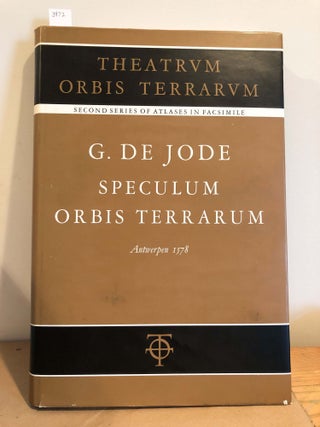
Speculum Orbis Terrarum 1578
Amsterdam: Theatrum Orbis Terraum Ltd, 1966. facsimile reprint edition. Hardcover. folio, bound in original dark light brown cloth covered boards and in near fine condition, this is a facsimile reprint (second series) originally published in 1578. The dust jacket is present and is in very good condition, there is some..... More
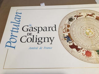
Portulan de Gaspard de Coligny Amiral de France
Chantilly: Bibliotheque du Musee Conde, 1995. First Edition. Paperback. folio , portfolio in cream color paper in near fine condition with contents of 4 pages of text in French and 10 very nicely printed images of early maps. pages ca. 12" x 19" with small amount of text on back..... More
![Item #2193 ROME AND ITS ENVIRONS [folding map]. Sir William Gell](https://carydalebooks.cdn.bibliopolis.com/pictures/2193.jpg?width=320&height=427&fit=bounds&auto=webp&v=1480733250)
ROME AND ITS ENVIRONS [folding map]
London: Saunders & Otley, 1834. 2nd. Hardcover. linen backed folding map of the environs of Rome that is lightly soiled. Housed in green cloth covered boards - hinge and backstrip professionally repaired. There are light ink stamped owner names on the back of the map in 3 or 4 places..... More
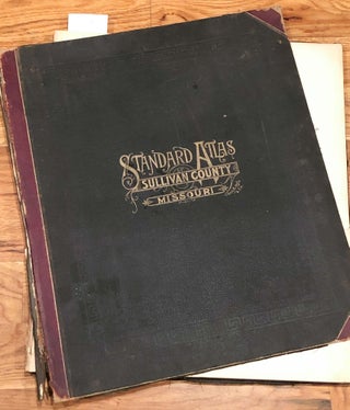
Standard Atlas of Sullivan County Missouri including a Plat Book of Villages, Cities, and Townships (1897)
Chicago: Geo. A. Ogle & Co., 1897. First Edition. Hardcover. elephant folio atlas ca. 15"x 18". of Sullivan County, Missouri, 1897, bound in original quarter leather with black blindstamped cloth covered boards that are in good condition, but detached from the book block. The leather at the joints has deteriorated..... More
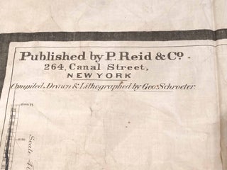
Profiles of Asia and Asia Independent Series of School Maps 1860
New York: R. Reid & Co., 1860. First Edition. unbound. two very large maps on silk ca. 42" x 92" ( 106cm x 233cm) for Profiles of Asia item- it shows a series of cuts across Asia indicating how the terrain varies. For the Asia map it is ca. 76"..... More

Linen backed folding Map Two Sheet Road Map England and Wales - South Sheet (1923)
London: Geographia, 1923. early. Cloth. Linen backed folding map, folding to ca. 4.5" x 8" and bound into dark blue stiff covers, Open sze ca. 31" x 40.5", paper is lightly age toned and lightly soiled, but in very good to near fine condition with good color. Roads of 11..... More
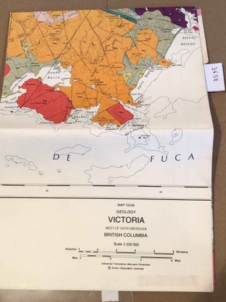
folded Map Geology of Victoria West of Sixth Meridian British Columbia
n.p. Surveys and mapping branch, 1983. First Edition. unbound. folded map, ca. 7"x9" , but ca. 45" x 40" unfolded, brightly colored , very little wear, light soiling on exposed sides, probably left folded a long time. unbound. Near fine copy. Note: due to size and weight, shipping outside the..... More
Geologic Atlas of the United States. Yellowstone folio 30 1896
Washington DC: United States Geological Survey, 1896. Early edition. Paperback. elephant folio, ca. 18.5" x 22" pp. 8 of text - including inside of front and rear covers, 2 of b&w photos, 4 of maps Gallatin, Shoshone, Canyon and Lake sections of the park (together making the whole of the..... More
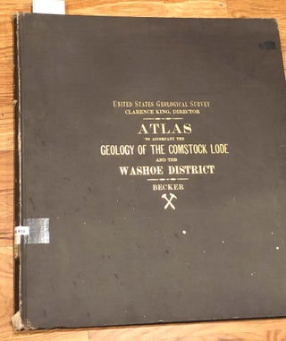
Atlas to Accompany the Monograph on the Geology of the Comstock Lode and the Washoe District (ATLAS ONLY)
Washington DC: Julius Bien, 1882. First Edition. Hardcover. elephant folio atlas ca. 17.5"x 20", 1882 ATLAS VOLUME ONY, binding in good condition, but x- library copy- from their reference collection, so less than usual wear- covers very good, but library label in spine, gift bookplate on front pastedown inside. Contents..... More